
Anúncios
Land Measurement App
Modern technology has revolutionized how we measure and map land, making complex surveying tasks accessible to everyone through innovative mobile applications.
Anúncios

Gone are the days when measuring land required expensive equipment, professional surveyors, and hours of manual calculations. Today’s smartphone technology brings GPS-powered precision to your fingertips, transforming how property owners, farmers, real estate professionals, and outdoor enthusiasts approach land measurement challenges.
Whether you’re planning a garden, buying property, managing farmland, or simply curious about the size of a nearby park, land measurement apps offer practical solutions that were unimaginable just a decade ago. These digital tools combine satellite technology, advanced algorithms, and user-friendly interfaces to deliver results that rival traditional surveying methods in many scenarios. 🌍
Anúncios
Why Traditional Land Measurement Methods Are Becoming Obsolete
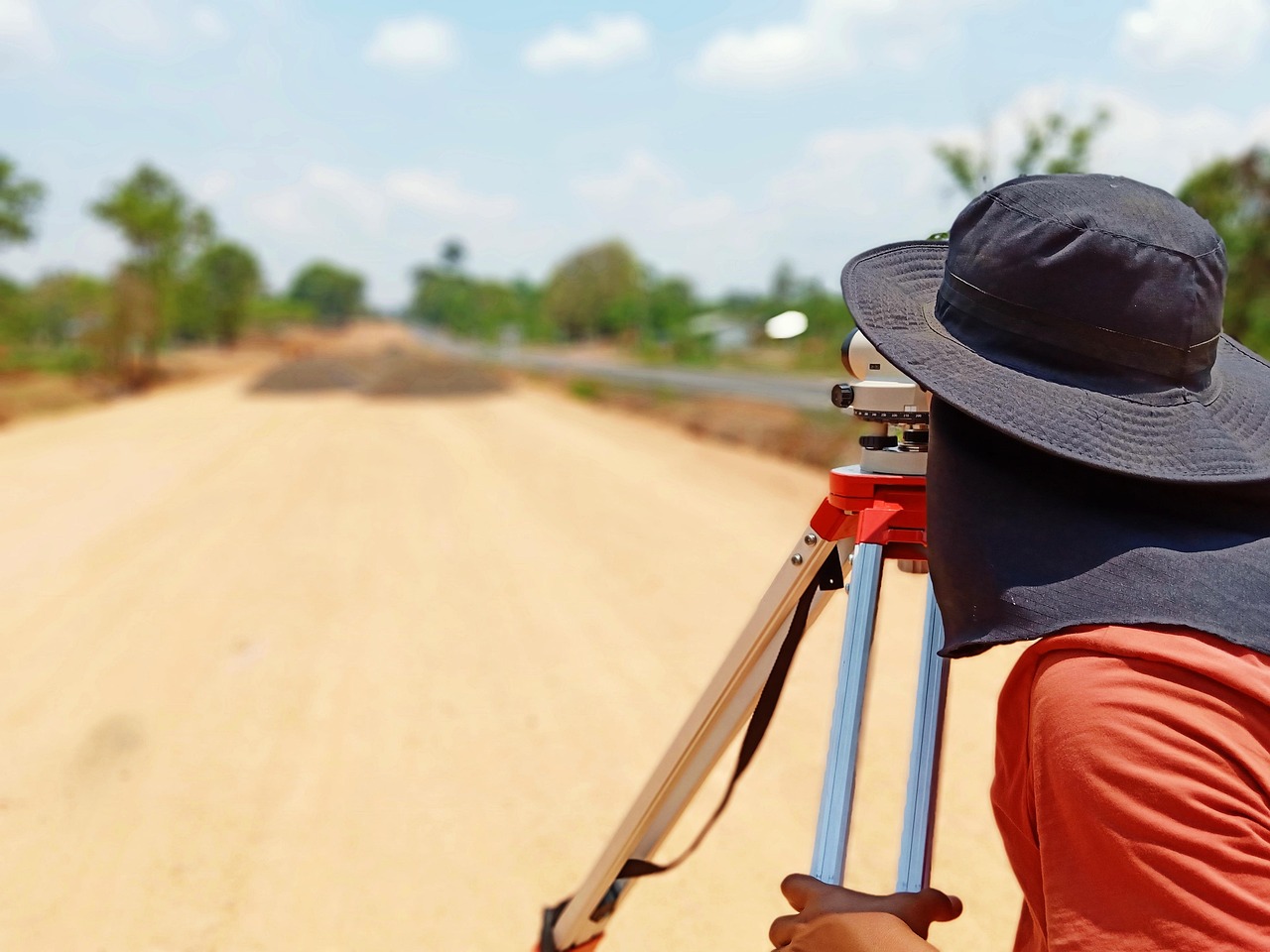
Traditional surveying techniques have served us well for centuries, but they come with significant limitations that modern technology elegantly solves. The conventional approach typically requires hiring licensed surveyors who arrive with theodolites, measuring chains, and other specialized equipment.
The costs associated with professional surveying can quickly escalate, especially for routine measurements or preliminary assessments. A simple property boundary verification might cost hundreds of dollars, while comprehensive surveys for larger plots can reach thousands. Time delays add another layer of frustration—scheduling appointments, waiting for weather conditions to clear, and processing results can stretch simple measurements into week-long projects.
Physical accessibility presents yet another challenge. Measuring irregular terrain, dense vegetation, or areas with obstacles becomes exponentially more difficult with traditional methods. Surveyors must physically traverse every inch of the property, which can be dangerous, time-consuming, or even impossible in certain conditions.
How Land Measurement Apps Transform Property Assessment 📱
Land measurement applications leverage your smartphone’s built-in GPS receiver to capture coordinate data as you walk around a property’s perimeter. The technology triangulates your position using signals from multiple satellites, creating precise location markers that the app connects to calculate area and perimeter measurements.
The process is remarkably straightforward. Users simply launch the app, start recording, and walk along the boundaries they wish to measure. The application plots each point on a digital map, automatically connecting them to form a polygon that represents the measured area. Advanced algorithms then calculate the total area, displaying results in various units—square feet, acres, hectares, or square meters—depending on your preference.
What makes these apps particularly valuable is their ability to save measurements for future reference. Property records become digital archives accessible whenever needed, eliminating the need for filed paperwork or searching through old documents. Many applications also allow users to attach photos, notes, and additional metadata to each measurement, creating comprehensive property documentation systems.
GPS Technology: The Engine Behind Accurate Measurements
Modern smartphones contain increasingly sophisticated GPS chips capable of achieving impressive accuracy levels. While consumer-grade GPS typically provides accuracy within 15-30 feet under open sky conditions, many land measurement apps employ additional techniques to enhance precision considerably.
Differential GPS correction, available through various services, can improve accuracy to within 3-10 feet. Some premium applications offer integration with external Bluetooth GPS receivers that achieve sub-meter or even centimeter-level precision when combined with real-time kinematic (RTK) correction services.
The satellite constellation available to your device also matters significantly. Devices that can access multiple global navigation satellite systems—including GPS (United States), GLONASS (Russia), Galileo (European Union), and BeiDou (China)—achieve better accuracy through increased satellite visibility and more robust position calculations.
Essential Features Every Quality Land Measurement App Should Offer
Not all measurement applications deliver equal functionality. Understanding which features matter most helps users select tools that match their specific needs and use cases. The best applications combine core measurement capabilities with thoughtful extras that enhance usability and value.
Area and Perimeter Calculations
The fundamental purpose of any land measurement app revolves around calculating area and perimeter accurately. Top-tier applications display these measurements in real-time as you walk, allowing you to verify boundaries and make adjustments before finalizing. Look for apps that support multiple unit systems and allow instant conversion between different measurement standards.
Distance Measurement Tools
Beyond property boundaries, quality apps include point-to-point distance measurement features. These tools prove invaluable when planning fence lines, irrigation systems, or determining setback requirements. Some applications even calculate elevation changes between points, adding a vertical dimension to your measurements. 📏
Map Layer Integration
The ability to overlay measurements on satellite imagery, topographic maps, or street maps provides critical context. Visual confirmation helps ensure you’re measuring the correct boundaries and reveals terrain features that might affect your project. Applications offering multiple map layer options give users flexibility based on available data connections and specific requirements.
Shape and Marker Placement
Manual point placement allows users to refine measurements without physically visiting every corner of a property. This feature becomes especially valuable when measuring from aerial imagery or when physical access to certain areas proves difficult. Editing capabilities let you adjust points, delete mistakes, and perfect your measurements before saving.
Data Export and Sharing Capabilities
Professional applications recognize that measurements often need sharing with contractors, clients, or authorities. Export options should include standard formats like KML (Google Earth), KMZ, GPX, and PDF. Cloud synchronization ensures your data remains accessible across devices and protected against device loss or failure.
Practical Applications Across Different Industries and Scenarios 🌾
Land measurement apps serve diverse users across multiple sectors, each finding unique value in mobile measurement technology. Understanding these applications helps identify how these tools might benefit your specific situation.
Agriculture and Farming Operations
Farmers use measurement apps to calculate field sizes for crop planning, determine fertilizer and seed requirements, and track harvest areas. The ability to measure remotely and save multiple field boundaries streamlines farm management significantly. Many agricultural professionals maintain comprehensive digital maps of their entire operations, tracking crop rotation, yield data, and soil treatment history for each measured area.
Real Estate Professional Tools
Real estate agents and property developers rely on quick, preliminary measurements during property showings and initial assessments. While these measurements don’t replace official surveys required for transactions, they provide valuable ballpark figures for marketing materials and client discussions. The ability to instantly calculate lot sizes and demonstrate property boundaries to potential buyers adds professional credibility and improves client service.
Landscaping and Garden Planning
Landscaping contractors measure project areas to estimate material needs, calculate costs, and plan designs. Homeowners planning gardens, patios, or outdoor living spaces use these same tools to visualize projects and shop for materials with accurate quantities. The visual nature of app-based measurements helps communicate design concepts to clients more effectively than abstract numbers alone.
Outdoor Recreation and Trail Mapping
Hikers, mountain bikers, and outdoor enthusiasts measure trail distances, map favorite routes, and document exploration areas. Conservation volunteers use measurement apps to track habitat restoration areas, invasive species treatment zones, and wildlife observation locations. The GPS tracking features double as safety tools, recording routes that can be shared with others or used for navigation back to starting points. 🥾
Construction and Development Planning
Construction professionals use measurement apps for preliminary site assessments, excavation volume estimates, and progress tracking. While detailed engineering surveys remain essential for final construction documents, mobile measurements accelerate early-stage planning and help identify potential issues before significant resources get committed to projects.
Accuracy Considerations: Understanding Limitations and Best Practices
While land measurement apps offer impressive capabilities, understanding their limitations ensures appropriate application and prevents reliance on measurements in situations requiring professional surveying precision.
Factors Affecting GPS Accuracy
Satellite visibility directly impacts measurement precision. Dense tree cover, tall buildings, and steep terrain can block or reflect GPS signals, reducing accuracy significantly. Weather conditions, particularly heavy cloud cover or precipitation, may also degrade signal quality. Electromagnetic interference from power lines, radio towers, or other sources can introduce additional errors.
The quality of your device’s GPS receiver matters considerably. Newer smartphones generally feature more advanced GPS chips with better sensitivity and multi-constellation support. Budget devices may struggle to achieve the same accuracy levels as flagship models, even when running identical applications.
Improving Measurement Precision
Several techniques help maximize the accuracy achievable with smartphone-based measurements. Measuring during optimal conditions—clear skies, minimal obstructions—provides the best results. Walking slowly and steadily around perimeters allows the GPS more time to refine position calculations at each point.
Taking measurements when the GPS indicates strong satellite lock, typically showing 8 or more satellites with good signal strength, ensures better data quality. Many apps display GPS accuracy estimates; waiting until this value stabilizes at its best level before starting measurements improves results noticeably.
Repeat measurements offer verification and averaging opportunities. Taking the same measurement multiple times and comparing results reveals the precision level you’re actually achieving. Significant variation between measurements suggests poor GPS conditions or technique issues requiring adjustment. ✅
When Professional Surveying Remains Essential
Legal property transactions, boundary disputes, construction permits, and subdivision applications typically require professionally stamped surveys meeting specific regulatory standards. Mobile measurement apps cannot replace licensed surveyors in these contexts, regardless of their accuracy.
However, these apps excel at preliminary measurements, planning exercises, and situations where approximate values suffice. Understanding this distinction helps users apply the technology appropriately while recognizing when professional services become necessary.
Selecting the Right Land Measurement App for Your Needs
The marketplace offers numerous land measurement applications ranging from basic free tools to sophisticated professional packages. Evaluating options against your specific requirements ensures you select an app that delivers appropriate functionality without unnecessary complexity or cost.
Free vs. Premium Applications
Free applications typically provide core measurement functionality with limitations on saved measurements, export options, or advanced features. Advertisement-supported models may interrupt workflows with promotional content. These options work well for occasional users with straightforward measurement needs.
Premium applications, available through one-time purchase or subscription models, remove limitations and add professional features. Advanced calculation options, unlimited storage, priority support, and additional tools justify costs for frequent users or professional applications. Trial versions allow testing before committing financially.
User Interface and Ease of Use
An intuitive interface reduces learning curves and minimizes errors during field measurements. Clear visual feedback, logical control placement, and straightforward workflows make apps accessible even when working outdoors in challenging conditions. Reading user reviews specifically addressing ease of use provides insight into real-world usability.
Offline Functionality
Many measurement scenarios occur in areas without cellular data coverage. Applications supporting offline operation, including cached map imagery and local data storage, function reliably regardless of connectivity. This capability proves essential for rural properties, remote worksites, and wilderness applications. 🗺️
Customer Support and Updates
Active development and responsive support indicate applications that will continue improving and adapting to operating system updates. Abandoned apps eventually become incompatible with newer devices or lose functionality as platforms evolve. Checking update frequency and developer responsiveness helps identify well-maintained applications worthy of long-term investment.
Privacy and Data Security Considerations
Land measurement applications collect potentially sensitive location data about your property and activities. Understanding how developers handle this information protects your privacy and prevents unwanted data exposure.
Review privacy policies before installing applications, particularly regarding data sharing with third parties, advertising networks, or analytics services. Some apps collect minimal data strictly for functionality, while others aggregate user information for various purposes. Applications offering local-only storage options provide maximum privacy by keeping all data on your device rather than cloud servers.
Consider the implications of cloud synchronization features. While convenient for backup and multi-device access, cloud storage means your property measurements reside on external servers. Reputable developers encrypt this data and maintain security standards, but risks remain inherent in any cloud-based storage system.
Future Developments in Mobile Land Measurement Technology
Emerging technologies promise even greater capabilities for mobile land measurement applications. Augmented reality features may soon overlay measurement data directly onto camera views, helping users visualize boundaries and dimensions in real-time. Integration with drone imagery could enable measurements from aerial perspectives without walking perimeters.
Improved GPS accuracy through expanded satellite constellations and advanced correction services will push consumer-grade precision closer to professional survey standards. Machine learning algorithms might automatically detect property boundaries from satellite imagery, requiring only user confirmation rather than complete manual measurement. 🚀
Integration with smart property management ecosystems could transform land measurement apps into comprehensive land stewardship platforms. Imagine applications that not only measure your property but also track maintenance schedules, monitor soil health through connected sensors, plan optimal layouts through AI assistance, and coordinate with service providers for automated scheduling.
Making Land Measurement Apps Work for You
Successfully incorporating land measurement applications into your workflow requires understanding both their capabilities and limitations. Start with simple measurements to build familiarity with your chosen app’s interface and accuracy characteristics. Compare results against known dimensions when possible to calibrate your expectations and technique.
Document your measurement methodology, noting conditions, settings, and procedures that produce optimal results. This practice-based knowledge helps you refine approaches and achieve consistent outcomes across different projects and locations.
Remember that these tools complement rather than replace professional expertise in situations requiring certified accuracy. Use them confidently for planning, estimation, and informal measurements while recognizing contexts where licensed surveyors remain essential.
The democratization of land measurement technology empowers property owners, professionals, and enthusiasts with capabilities previously requiring specialized training and expensive equipment. By understanding how to leverage these tools effectively, you gain valuable insights into your property and projects while making more informed decisions about land use, development, and management. The power to measure land now literally fits in your pocket, ready whenever curiosity or necessity calls. 🌟
